 vesseltracker.com
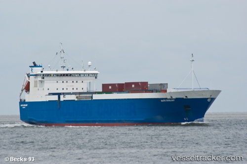
Vessel AYA M IMO: 9007867, MMSI: 352001122 Ro-Ro Cargo Ship
UTC, 33.88500, 13.86500, course: -1, speed: 11
UTC, 34.26085, 13.60236, course: 333, speed: 11
2026-03-09 15:56:55 UTC, 34.57333, 13.47166, course: -1, speed: 8
Live Vessel AYA M Analytics (details, animations, etc.)
Live AIS position: UTC. 27 nm SW of Bani Walid), updated 2026-03-09 15:56:55 UTC.Find the position of the vessel AYA M on the map. The latter are known coordinates and path.
marine traffic ship tracker show on live map
The current position of vessel AYA M is 34.57333 lat / 13.47166 lng. Updated: 2026-03-09 15:56:55 UTCCurrently sailing under the flag of Panama
AYA M built in 1995 year
Deadweight:
6293 tDetails:
Last coordinates of the vessel:
UTC, 33.22333, 14.35667, course: -1, speed: 11UTC, 33.88500, 13.86500, course: -1, speed: 11
UTC, 34.26085, 13.60236, course: 333, speed: 11
2026-03-09 15:56:55 UTC, 34.57333, 13.47166, course: -1, speed: 8